
Southern California is in for a wild weather ride this week, as a powerful storm system is set to bring heavy rain, flash flooding, and possible evacuations. Officials have issued a Flash Flood Watch for Los Angeles and Ventura Counties, warning that certain areas could see dangerous flooding and mudslides starting Thursday afternoon and lasting into early Friday morning.
Who’s at Risk?
Not all parts of LA will be affected the same way, but certain areas face a much bigger danger—especially those near recent wildfire burn scars where the ground can’t absorb water properly. The National Weather Service (NWS) says the Eaton, Palisades/Franklin, and Bridge burn scars are at highest risk for flash floods and debris flows.
For people living near these areas, the threat is real. Heavy rain in burn scar regions often leads to fast-moving mudslides that can destroy homes, block roads, and trap residents with little warning.
What to Expect from This Storm
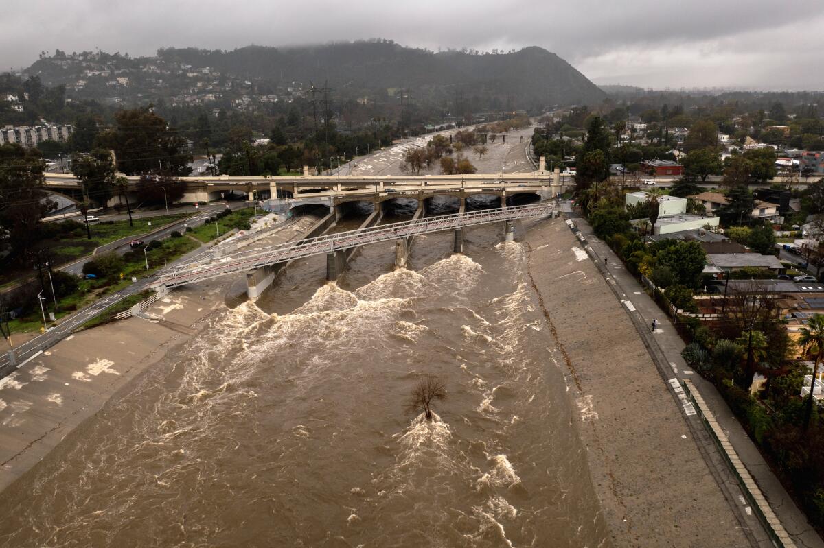
This isn’t just your average rainy day in LA. Forecasters warn that the system moving in Thursday afternoon will bring:
- Heavy Rainfall: Expect intense downpours, especially Thursday evening into the night.
- Flash Flooding: Water levels in streets and rivers could rise rapidly, turning roads into rivers within minutes.
- Mudslides & Debris Flows: Burn scar areas could see dangerous slides of mud, rocks, and trees, threatening homes and roads.
- Power Outages & Road Closures: Downed trees and flooding could make some areas impassable.
What You Should Do to Prepare
If you live in a flood-prone or high-risk area, now is the time to get ready. Officials are urging residents to:
- Stay Updated: Keep an eye on weather alerts from the NWS and local emergency officials.
- Be Ready to Evacuate: If you’re in a high-risk area, pack an emergency bag with essentials, including important documents, medications, and supplies. Evacuation orders can come fast—don’t wait until it’s too late.
- Avoid Flooded Roads: It takes just six inches of fast-moving water to knock you off your feet and a foot of water to sweep away a car. Never try to drive through floodwaters!
- Secure Your Home: Use sandbags if needed, clear drains, and move valuables to higher ground if you’re in a flood-prone area.
Why This Storm Is So Dangerous
Los Angeles isn’t used to heavy rain, and when it comes all at once, the city’s drainage systems can get overwhelmed fast. Add in the burn scars from recent wildfires, and you have a recipe for disaster. The ground in those areas is basically waterproof, so rain runs straight down in powerful, fast-moving waves—sometimes bringing mud, rocks, and trees along with it.
That’s why flash floods happen so suddenly. If you live in a burn scar area, you could go from dry ground to waist-deep water in minutes.
How Long Will This Last?
The Flash Flood Watch is in effect from Thursday afternoon until early Friday morning. However, the worst of the storm is expected Thursday night, when the heaviest rain is likely to fall.
Final Warning: Don’t Take This Lightly
If you live in a flood-prone area, take action now. Flash floods are fast, deadly, and nearly impossible to escape once they start. Emergency officials stress that waiting until the water rises is too late.
Stay informed, stay prepared, and stay safe as this major storm moves in.


