
If you were hoping for a peaceful and cozy Valentine’s Day in Vermont, Mother Nature has other plans. A powerful winter storm is set to sweep across the state, bringing heavy snowfall, icy conditions, and gusty winds that could make travel extremely hazardous.
Forecasters are warning residents to prepare for dangerous road conditions, potential power outages, and bitterly cold temperatures as the storm unfolds over the next few days. Here’s what you need to know.
THURSDAY: SNOW ARRIVES EARLY, TURNING INTO A DANGEROUS WINTRY MIX
Thursday will start with steady snowfall, quickly covering roads and making the morning commute tricky. As the day progresses, warmer air will push in, causing snow to mix with sleet and freezing rain.
By late morning, conditions could become especially treacherous as ice starts to coat roadways, sidewalks, and power lines. Snowfall accumulations of 1 to 4 inches are expected, with higher totals in the St. Lawrence Valley.
Adding to the chaos, strong winds will whip through the region, particularly along the slopes of the Green Mountains and parts of the Adirondacks. These gusts could bring down tree limbs and power lines, increasing the risk of outages.
If you must be on the road, exercise extreme caution—icy conditions could make even short trips dangerous.
FRIDAY: A COLD BUT BRIEF BREAK FROM THE STORM
By Friday, the storm will move out, leaving behind a cold but calmer day. The skies will clear up slightly, and temperatures will reach a high of 24°F (-4°C) before plummeting to a bone-chilling 4°F (-16°C) overnight.
Even though the worst of the storm will have passed, roads may still be icy, and any leftover slush will freeze solid overnight. If you’re traveling or heading out for Valentine’s Day plans, be prepared for frigid conditions.
SATURDAY: ANOTHER ROUND OF SNOW MOVES IN
Just as Vermont catches its breath, another weather system will roll in on Saturday, bringing more clouds and light snow showers. While this second round won’t be as intense as Thursday’s storm, it could still add another 1 to 2 inches of snow, keeping roads slippery.
Daytime highs will stay around 21°F (-6°C), with overnight temperatures dropping to 15°F (-9°C).
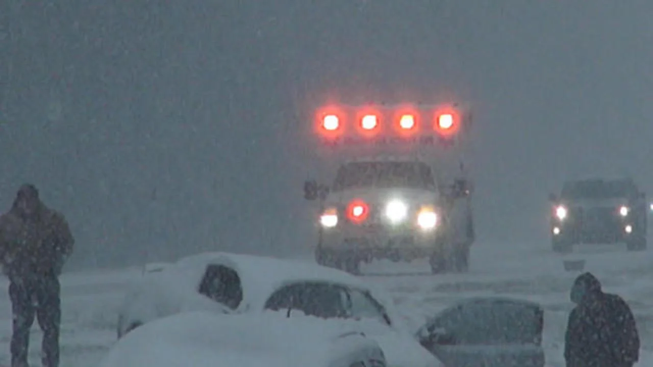
TRAVEL WARNING: EXTREMELY DANGEROUS CONDITIONS EXPECTED
Between heavy snow, sleet, freezing rain, and gusty winds, this storm will create hazardous travel conditions across Vermont. If you must drive, slow down, allow extra stopping distance, and check for road closures.
Key safety concerns include:
- Icy roads: Sleet and freezing rain will make driving hazardous, especially on bridges and overpasses.
- Reduced visibility: Snowfall and blowing snow could make it difficult to see while driving.
- Power outages: Strong winds and ice accumulation could bring down power lines in some areas.
FINAL THOUGHTS: PREPARE NOW BEFORE CONDITIONS WORSEN
This storm has the potential to cause major disruptions across Vermont, especially on Thursday when snow will transition into a dangerous icy mix.
Make sure to stock up on essentials, charge your devices in case of power outages, and avoid unnecessary travel when conditions deteriorate.


