
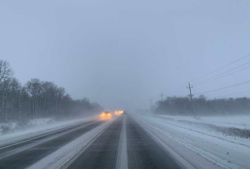
Wisconsin residents should prepare for a messy and potentially dangerous weekend as a powerful storm system is set to bring freezing rain, sleet, and snow from Friday night through Sunday. The National Weather Service has issued alerts, warning of hazardous road conditions, power outages, and travel disruptions across the state.
What’s Coming and When?
The storm is expected to begin late Friday, starting as rain in some areas before transitioning into freezing rain and sleet as temperatures drop. By Saturday, northern Wisconsin will likely see significant ice accumulation, making travel treacherous.
Southern parts of the state, including Milwaukee and Madison, may experience mostly rain on Saturday, but as the storm continues into Sunday, colder air will push south, turning precipitation into a wintry mix or wet snow. Areas farther north, including Green Bay and the Upper Peninsula of Michigan, are expected to see the heaviest snow, with accumulations potentially reaching several inches.
Potential Impacts of the Storm
-
Icy, Slippery Roads: Freezing rain and sleet will make roads dangerously slick, increasing the risk of accidents. Bridges and overpasses will be especially hazardous.
-
Power Outages Possible: Ice accumulation on power lines and trees may lead to outages in parts of northern and central Wisconsin. Residents should prepare for possible blackouts.
-
Tree Damage Likely: The weight of ice and wet snow could snap tree limbs, potentially causing property damage and blocking roads.
-
Disrupted Travel Plans: Whether you’re driving locally or planning a weekend trip, this storm could cause major headaches on the roads and at airports. Flight delays and cancellations are possible.
How to Stay Safe
-
Avoid Unnecessary Travel: If you must drive, slow down, allow extra stopping distance, and check road conditions before heading out.
-
Prepare for Power Outages: Charge your devices, gather emergency supplies, and have alternative heating options available in case of prolonged outages.
-
Check on Neighbors and Loved Ones: Elderly or vulnerable individuals may need assistance preparing for the storm, so reach out to ensure they have everything they need.
-
Stay Updated: Keep an eye on weather forecasts and emergency alerts as conditions may change rapidly.
Weekend Outlook
The worst of the storm is expected Saturday into early Sunday. By late Sunday, temperatures will slowly begin to rise, and precipitation will start to taper off. However, icy roads and lingering snow could continue to make travel difficult into early next week.
This storm is a reminder that winter isn’t quite ready to let go of Wisconsin just yet. Take precautions, stay informed, and be ready for a challenging weekend ahead.


