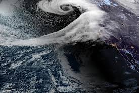
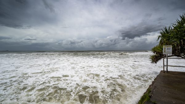
SEATTLE, WA – The Pacific Northwest is bracing for a powerful series of storms set to bring damaging winds, heavy rainfall, and significant mountain snowfall through April 3. Forecasters warn that the storm system, fueled by a strong low-pressure system moving in from the Gulf of Alaska, will create hazardous conditions across Northern California, Oregon, and Washington over the next several days.
Storm Timeline and Expected Impacts
Meteorologists predict that the worst of the storm will hit between March 31 and April 3, with multiple waves of heavy precipitation and dangerous wind gusts reaching up to 60 mph in some coastal and inland areas.
High Winds Expected to Cause Damage
-
Strong wind gusts of 50-60 mph are expected along the coasts of Oregon and Northern California, with the potential for downed power lines, falling tree limbs, and widespread power outages.
-
Inland areas, including Seattle and Portland, could see gusts of 40-50 mph, making travel hazardous for high-profile vehicles.
Heavy Rainfall and Flooding Concerns
-
Rainfall totals of 1 to 2 inches are expected in most lowland areas, but some localized spots could see as much as 5 inches.
-
Urban flooding is possible, especially in areas with poor drainage. Rivers and streams may rise quickly, increasing the threat of flash flooding.
-
Motorists should avoid driving through flooded roadways, as water levels can rise unexpectedly.
Heavy Snow to Hit Mountain Passes
-
The Sierra Nevada, Klamath, and Cascade mountain ranges could see several feet of snow, making travel treacherous.
-
Major highways, including I-5 and I-80, could experience closures or significant travel delays due to snow and ice.
-
Anyone traveling through mountain passes is advised to carry emergency supplies, including chains, blankets, and extra food and water.
How to Stay Safe During the Storm
Residents in affected areas should take precautions now to prepare for potential power outages, flooding, and hazardous road conditions.
-
Secure loose outdoor items that could be blown away by high winds.
-
Stock up on emergency supplies, including flashlights, batteries, bottled water, and non-perishable food.
-
Limit unnecessary travel, especially in mountain areas where snow and ice could make roads impassable.
-
Check for weather updates regularly, as conditions could change quickly.
What’s Next?
Forecasters expect the storm pattern to begin easing after April 3, with conditions gradually improving toward the weekend. However, the long-range forecast suggests additional storm systems could develop later in April, keeping the region on high alert for more extreme weather.
Officials urge residents to stay informed and follow evacuation orders or advisories if issued. The combination of strong winds, heavy rainfall, and snowfall could lead to life-threatening situations if precautions are not taken.


