
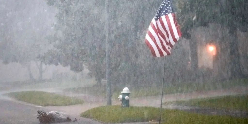
A powerful storm system is set to drench the Texas Gulf Coast over the next two days, bringing up to 10 inches of rain and dangerous flash flooding to millions. The National Weather Service has issued Flash Flood Warnings across the region, urging residents to prepare for possible evacuations and impassable roads.
The heaviest rainfall is expected to impact areas from Corpus Christi to Galveston, including Houston, Beaumont, and Victoria. With rainfall rates potentially exceeding 2 inches per hour, floodwaters could rise quickly, trapping drivers and swamping neighborhoods.
When and Where Will the Worst Rain Hit?
The downpours are expected to intensify Wednesday afternoon, continuing into Thursday morning. Some storms may linger into Friday, bringing additional rainfall to already saturated ground. Meteorologists warn that coastal cities and low-lying areas will be hit hardest, with flood-prone neighborhoods at the greatest risk.
Along with relentless rain, the system could produce strong thunderstorms with damaging winds and frequent lightning. While the tornado threat remains low, waterspouts and brief spin-up tornadoes along the coast are possible.
Flash Flood Dangers: Why This Storm is Serious
Flooding is one of the deadliest weather hazards, and this storm could turn streets into rivers in minutes. Texas’ flat terrain and urban areas with poor drainage, such as parts of Houston, make flash flooding a major concern.
Key flood dangers include:
-
Impacted roadways: Streets, highways, and underpasses could become submerged and impassable.
-
River and bayou overflow: Water levels in local waterways may rise rapidly, spilling into surrounding areas.
-
Urban flooding: Parking lots, low-lying neighborhoods, and even homes could take on water in a matter of hours.
How to Stay Safe as the Storm Moves In
Officials are urging residents to take this storm seriously and avoid unnecessary travel. Safety precautions include:
-
Never drive through flooded roads—as little as six inches of fast-moving water can sweep away a vehicle.
-
Prepare an emergency kit with flashlights, extra batteries, food, water, and important documents in case of power outages or evacuations.
-
Stay informed by monitoring local news, emergency alerts, and NOAA weather updates.
-
Move to higher ground if flooding begins in your area—do not wait until it’s too late.
What’s Next?
Forecasters expect conditions to improve by late Thursday, but standing water and ongoing flood risks could last into the weekend. Additional rain later in the week could keep rivers and drainage systems overflowing, leading to continued flooding threats in some areas.
This storm has the potential to bring life-threatening flooding across the Texas Gulf Coast. Stay alert, take precautions, and avoid floodwaters to keep yourself and your family safe.


