
Illinois – Illinois residents are bracing for severe weather beginning Wednesday, as the National Weather Service (NWS) has issued warnings for large hail and heavy rainfall across the state. The storm system will impact areas east of I-55 and south of I-70, with damaging weather expected to begin in the early afternoon and continue into the evening.
What to Expect from the Storm System
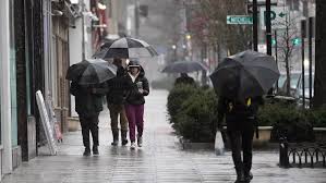
Severe thunderstorms are expected to develop on Wednesday, bringing large hail, gusty winds, and heavy rain to central and southern Illinois. The NWS has warned that some of the storms could produce hailstones larger than 2 inches in diameter, particularly east of I-55. These powerful storms will be capable of causing damage to vehicles, roofs, and crops, as well as creating dangerous driving conditions due to hail and flooding.
In addition to the hail threat, heavy rainfall is expected to accumulate across the region, particularly south of I-70. Some areas could see up to 3 inches of rain, leading to localized flooding. The combination of hail, strong winds, and rain will make for hazardous conditions, especially in urban areas where drainage systems may struggle to cope with the heavy downpours.
Areas Affected by the Storm Threat
The storm threat will primarily affect areas east of I-55 and south of I-70, including cities like Springfield, Champaign, Decatur, and Carbondale. While storms are expected to move across the entire state, these regions will experience the most severe conditions. The NWS has emphasized the potential for significant damage from large hail and flooding in these areas, urging residents to stay alert and prepare for rapidly changing weather conditions.
The storms are expected to develop around noon on Wednesday, with the heaviest weather arriving in the late afternoon and evening. Residents in these regions should be prepared for rapidly deteriorating weather conditions, particularly if they are planning to travel during the storm.
Impact on Travel and Safety Precautions
Travel could be severely impacted during the storm, especially in areas where hail and heavy rain are expected. Drivers are urged to avoid unnecessary travel during the peak of the storm, particularly in areas where visibility will be reduced due to heavy rain and hail. Roads may become slippery and flood-prone, and large hail could cause significant damage to vehicles.
For those already on the road, it is advised to seek shelter in a safe location if the storm becomes intense. If you are unable to find shelter, stay in your vehicle and avoid parking under trees or near power lines, as high winds may cause debris to fall.
Storm Safety Tips and Preparations
As the storm system moves through Illinois, residents are advised to take the following precautions:
-
Secure outdoor items that could be blown away by strong winds, such as patio furniture, trash cans, and garden tools.
-
Keep a weather radio or your phone charged to stay updated on the latest weather alerts.
-
If hail begins to fall, take shelter indoors or in a sturdy structure. Avoid windows and doors.
-
Keep your car emergency kit ready, with essentials such as a flashlight, first aid supplies, and bottled water.
-
If you live in a flood-prone area, make sure your sump pump is working and that you have sandbags on hand to help protect against flooding.
Looking Ahead: Storms to Move Through by Wednesday Night
The severe weather is expected to move out of Illinois by late Wednesday evening, with conditions improving as the night progresses. However, any residual rain could lead to continued flooding in some areas, especially in low-lying regions. Once the storm clears, temperatures are expected to remain mild, with a return to more typical spring weather in the days following the storm.


