
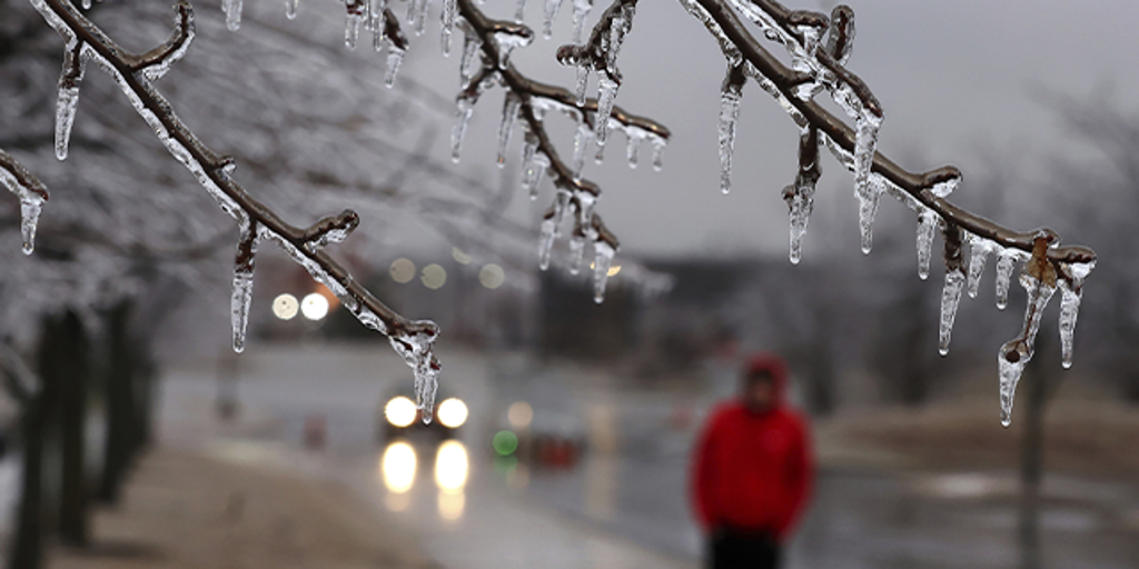
A powerful winter storm is gripping Champaign and Bloomington, Illinois, making roads dangerously slippery. The National Weather Service has issued a Winter Weather Advisory, in effect until 10 AM on Saturday, February 15. Drivers are urged to stay cautious as freezing rain and snow continue to coat the region, making travel conditions hazardous.
What to Expect
The storm is bringing a messy mix of snow, sleet, and freezing rain, creating icy patches on roads, sidewalks, and bridges. Forecasters predict up to one inch of snow and a thin layer of ice, enough to cause accidents if drivers aren’t careful. Temperatures are hovering around 33°F (0°C), which means ice may not be immediately visible but can still be dangerously slick.
Travel Warning
With road conditions worsening overnight, authorities are urging residents to slow down, avoid sudden braking, and give themselves extra time for travel. Bridges and overpasses will freeze first, increasing the risk of accidents. If you don’t absolutely need to be on the road, it’s best to stay home until conditions improve.
The Weekend Weather Outlook
- Saturday, February 15: More rain and snow expected, with accumulations of 1-3 cm. High of 39°F (4°C), but temperatures will drop to 24°F (-4°C) at night.
- Sunday, February 16: A morning snow shower followed by strong winds and colder temperatures. Highs near 26°F (-4°C), lows dropping to 5°F (-15°C).
- Monday, February 17 – Thursday, February 20: A deep freeze sets in, with bitterly cold temperatures as low as -4°F (-20°C) by midweek.
Final Warning
This storm is expected to move out by late Saturday morning, but the cold temperatures and lingering ice could make travel tricky for days. If you must drive, do so with extreme caution. For real-time road updates, check gettingaroundillinois.com. Stay warm and stay safe!


