
Indiana residents should brace for a dangerous mix of snow, sleet, and freezing rain overnight, as a powerful winter storm moves through the region. The National Weather Service has issued a Winter Weather Advisory from 11 PM Friday until 10 AM Saturday, warning of treacherous driving conditions, potential power outages, and dangerously slick roads.
According to meteorologists, this storm will bring up to 1 to 3 inches of snow in northern parts of the state, followed by a layer of ice up to a quarter-inch thick in some areas. This amount of ice is enough to cause vehicles to slide, make sidewalks unsafe, and even bring down power lines due to the weight of accumulating ice on tree branches.
When & Where the Storm Will Hit
- Friday Night (11 PM – 3 AM): The first round of precipitation will begin as snowfall in northern Indiana, including South Bend, Fort Wayne, and Elkhart.
- Early Saturday (3 AM – 7 AM): As temperatures hover around freezing, snow will transition to a mix of sleet and freezing rain, making untreated roads exceptionally slippery.
- Saturday Morning (7 AM – 10 AM): Icy conditions will continue, with some areas experiencing additional light freezing rain before the system moves out. Roads could remain dangerous even after precipitation stops, as ice may linger on shaded roads and overpasses.
Worst Affected Areas
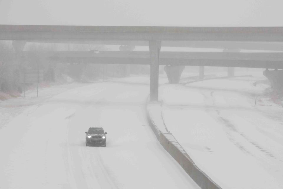
The highest impact is expected in northern and central Indiana, particularly in St. Joseph, Elkhart, and Allen counties. Elevated roadways, bridges, and rural roads will freeze over first, making them especially hazardous.
Travel Warning: Avoid Driving If Possible
Road crews will be working through the night, but rapid ice accumulation could make their efforts less effective. If you must drive, be prepared for:
- Black ice on highways, especially near bridges and overpasses.
- Reduced visibility due to blowing snow early in the storm.
- Longer stopping distances—even on treated roads.
If you have travel plans Saturday morning, consider delaying your departure until at least late morning, when conditions are expected to improve as temperatures rise above freezing.
Could Power Outages Happen?
With up to 0.25 inches of ice possible, tree branches may become heavy enough to snap, damaging power lines and causing localized outages. Residents should prepare by:
- Charging phones and devices ahead of time.
- Keeping extra blankets and flashlights on hand in case of a power failure.
- Checking on elderly neighbors or those who rely on medical equipment that requires electricity.
How Long Will It Last?
The worst of the storm is expected to pass by mid-morning Saturday, but roads could remain slick well into the afternoon. Temperatures are forecasted to rise slightly, helping melt some ice, but overnight refreezing could create more icy patches by Sunday morning.
Final Word: Stay Safe and Stay Off the Roads If You Can
This storm may not bring the heaviest snowfall of the season, but the combination of ice, freezing rain, and bitter cold makes it one of the most dangerous. If you don’t absolutely need to drive Saturday morning, it’s best to wait. Keep checking local weather alerts, and if you do go out, drive slowly, be cautious, and stay safe.


