

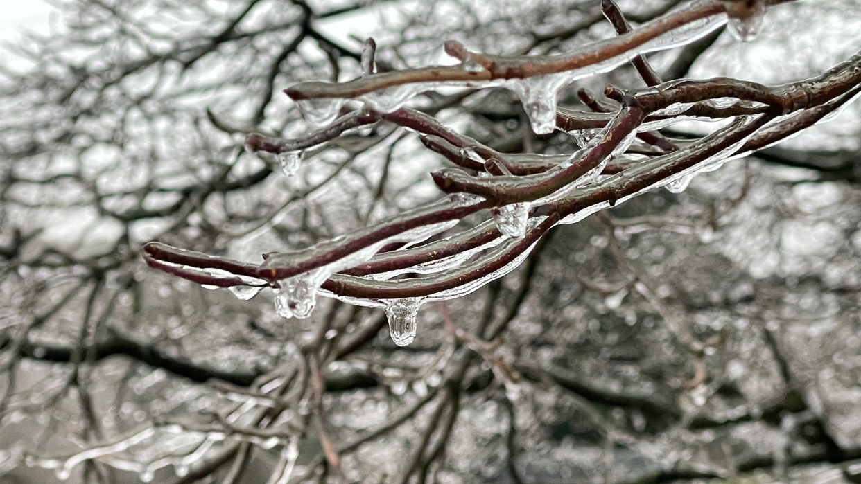
A powerful winter system is moving through Maryland, Virginia, and West Virginia, bringing dangerous freezing rain and creating treacherous travel conditions across the region. The National Weather Service has issued a Winter Weather Advisory, warning residents that ice accumulations could reach up to 0.2 inches, making roads, sidewalks, and power lines dangerously slick. The advisory remains in effect until 7 PM Saturday.
Current Conditions & What to Expect
As of this morning, temperatures are hovering just above freezing, with cloudy skies and occasional light precipitation. However, as the system strengthens throughout the day, rain will transition into freezing rain, especially in higher elevations and colder pockets.
- Baltimore, MD: Cloudy, 35°F (2°C)—expect freezing rain by early afternoon.
- Richmond, VA: Mostly cloudy, 35°F (2°C)—rain turning to freezing rain by midday.
- Charleston, WV: Cloudy, 36°F (2°C)—ice expected through the afternoon, particularly in shaded areas and hillsides.
This icy glaze will coat bridges, overpasses, and untreated roads first, making them particularly hazardous. In some areas, icy buildup on power lines and trees could lead to isolated power outages.
Travel Advisory: Roads Could Become Extremely Dangerous
Officials are urging residents to avoid unnecessary travel, as roads could turn into sheets of ice. Even a thin layer of ice can cause vehicles to skid uncontrollably, especially on untreated surfaces. If you must drive, slow down, increase your following distance, and avoid sudden braking.
Bridges and overpasses will freeze first, as they lose heat faster than the surrounding pavement. Expect especially hazardous conditions on:
- I-95 from Baltimore to Richmond
- I-81 through Virginia and West Virginia
- Highway 50 in West Virginia’s higher elevations
Could Power Outages Happen?
Yes. Ice accumulation on trees and power lines can weigh them down, causing branches to snap and disrupt power. Utility companies are already on standby for possible outages. If you experience an outage, do not touch downed power lines and report issues to your local provider immediately.
How Long Will the Ice Last?
The worst conditions are expected from midday until early evening. As temperatures rise slightly later tonight, freezing rain will transition to regular rain, reducing the immediate risk of further ice accumulation. However, residual ice on roads could refreeze overnight, creating slick spots on Sunday morning.
What You Should Do to Stay Safe
- Stay indoors if possible—Avoid walking or driving on icy surfaces.
- Prepare for power outages—Charge your devices, have extra blankets ready, and keep flashlights handy.
- Check on vulnerable neighbors—Elderly individuals and those with mobility issues may need assistance.
- Stay updated on road conditions—Call 511 or check your state’s Department of Transportation website before heading out.
Final Word: This Storm Isn’t Over Yet
While the freezing rain will taper off later tonight, lingering ice and refreezing could make Sunday morning just as dangerous. If you don’t have to travel, it’s best to stay put. Keep checking local weather updates and be prepared for rapidly changing conditions


